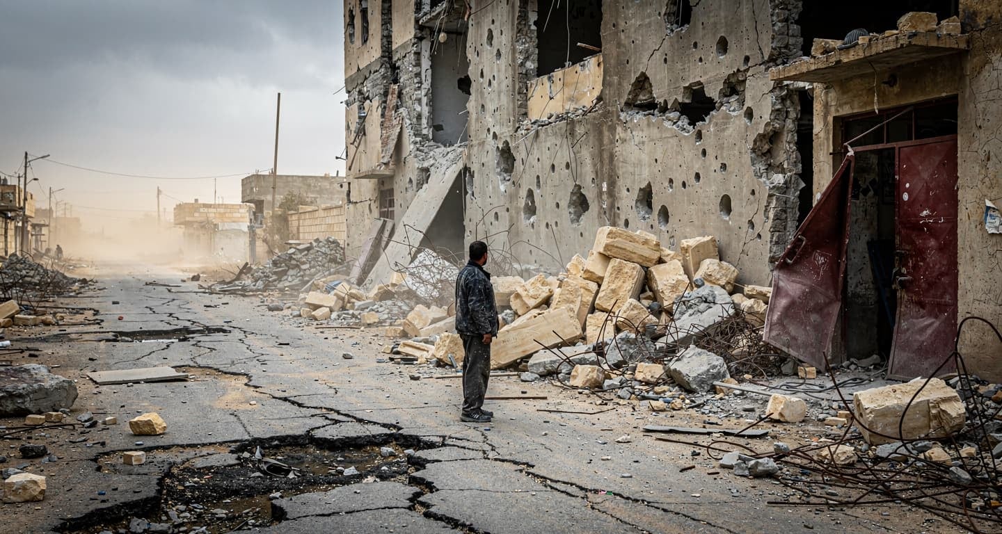
Four governments agree: stay 10km from Turkey’s Syrian and Iraqi borders, and you’ll join the 35 million tourists who visit safely each year. The US State Department maintains a Level 4: Do Not Travel advisory for Sirnak, Hakkari, and the 10km Syrian border zone—the same classification as active war zones. Meanwhile, Istanbul, Cappadocia, Antalya, and Izmir operate at Level 2: Exercise Increased Caution, identical to most Western European capitals.
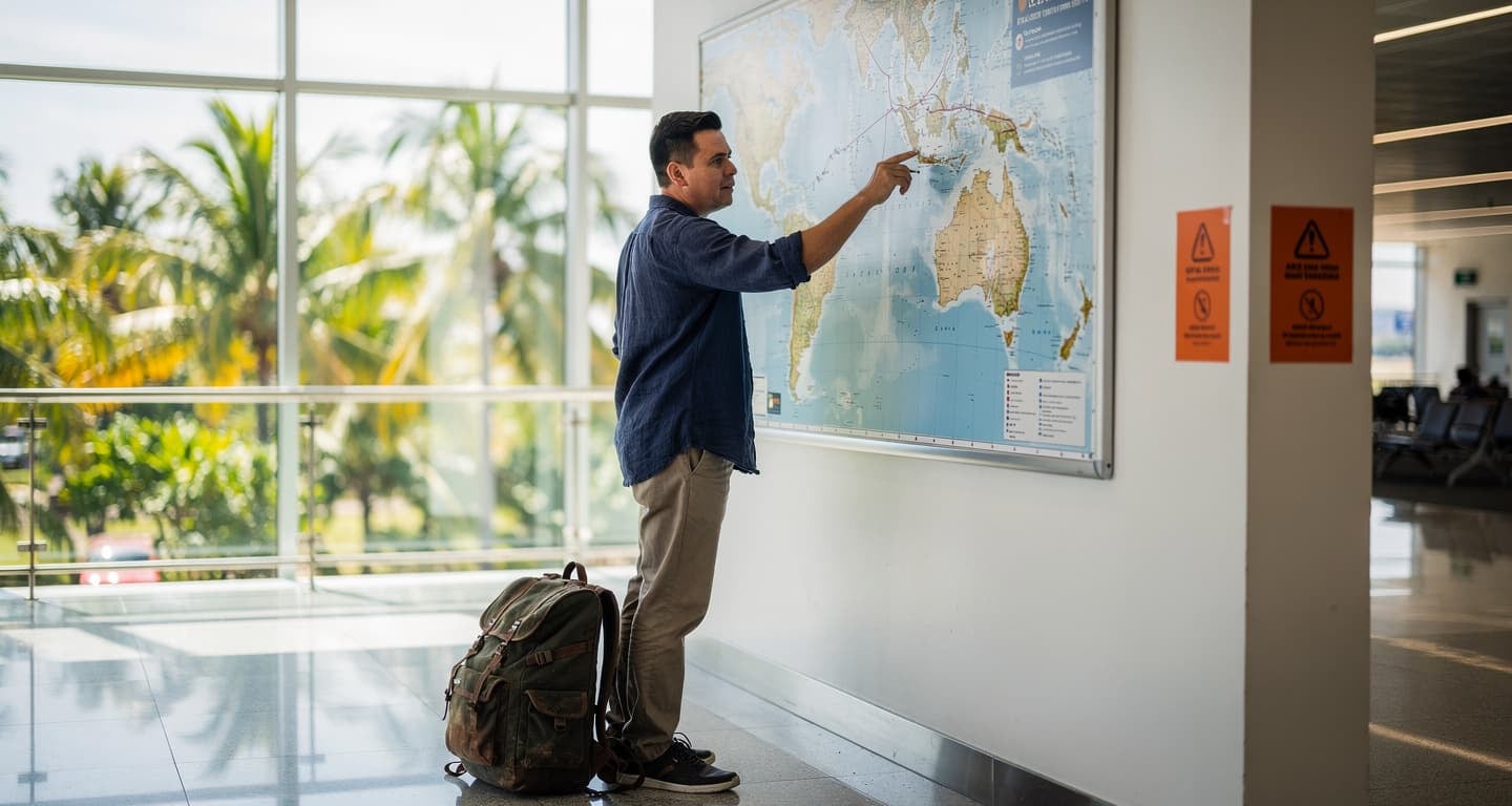
The geographic math is straightforward: Turkey’s popular tourist corridor sits 500-800km from any border conflict. Antalya’s beaches are further from Syria than Paris is from London. For travelers from North America, Europe, and Australasia planning trips between January and December 2026, this distance creates a clear decision framework—avoid the southeast entirely, and Turkey offers European-level security with Middle Eastern prices.
Air Traveler Club’s travel advisory monitoring system tracks government warnings from the US, UK, Canada, and Australia daily, identifying the January 2026 UK FCDO update that reinforced the 10km border exclusion zone while confirming tourist corridors remain unchanged.
The four-government consensus on Turkey’s danger zones
Every major Western government draws the same line. The US State Department restricts government employees from 13 provinces including Hatay and Gaziantep, while advising all Americans to avoid Sirnak, Hakkari, and the 10km Syrian buffer. Canada mirrors this with “avoid all travel” within 10km of Iraq and Syria. The UK’s January 16, 2026 update advises against all travel to the same zones. Australia classifies the border region as “high threat” for terrorism and military operations.
This alignment matters for insurance. Ignoring Level 4 advisories typically voids travel insurance coverage—a $5,000+ medical evacuation risk if something goes wrong in restricted areas.
The 10km rule explained
The buffer zone applies to any point within 10 kilometers of the Syrian or Iraqi border, covering portions of Hatay, Kilis, and Gaziantep provinces. Use Google Earth with border overlays for precision planning—some towns appear safe on maps but fall within the exclusion zone.
Province-by-province risk matrix
Not all Turkish provinces carry equal risk. The table below synthesizes US, UK, Canadian, and Australian advisories into a single decision framework:
| Province/Area | Distance to Border | Advisory Consensus | Tourist Viability | Annual Visitors |
|---|---|---|---|---|
| Istanbul | >800km Syrian | Level 2 | High | 15M+ |
| Antalya Coast | >600km Syrian | Level 2 | High | 20M+ |
| Cappadocia (Nevşehir) | >400km Syrian | Level 2 | High | 3M+ |
| Izmir | >700km Syrian | Level 2 | High | 4M+ |
| Gaziantep | <10km Syrian (parts) | Level 3-4 | Low | 1M (declining) |
| Sirnak | 0-10km Syrian/Iraqi | Level 4 | None | <10K |
| Hakkari | 0-10km Iraqi | Level 4 | None | <5K |
The pattern is clear: 99% of Turkey’s tourism infrastructure sits in Level 2 zones. The problematic provinces receive fewer combined visitors than a single Istanbul neighborhood.
Flight deals
most people never see
Our AI monitors 150+ airlines for pricing anomalies that traditional search engines miss. Air Traveler Club members save $650 per trip per person on average: see how it works.
Each deal saves 40–80% vs. regular fares:

Flight operations: which airports to avoid
Proximity to conflict zones disrupts regional air operations. Gaziantep Airport (GZT) and Hatay Airport (HTY) both serve provinces under US government employee restrictions, with documented flight disruptions from border security operations. The US State Department specifically notes GZT’s vulnerability to spillover from Syrian border clashes.
For travelers seeking southeastern Turkey’s cultural sites, the calculus has changed. Route through Antalya (AYT) or Adana (ADA) instead, both operating normally with no advisory restrictions. Our analysis of [Asia-Pacific hub airports](https://www.airtraveler.club/blog/best-european-airport-hubs-for-cheap-flights-to-asia/) applies similar logic—choosing gateways based on operational reliability rather than geographic convenience.
One positive development: Turkey’s land borders with Iran reopened on January 12, 2026, with three crossing points (Gürbulak, Kapıköy, Esendere) now operational. However, overland routes through southeastern Turkey remain high-risk—fly direct to Istanbul instead.
The safe itinerary: Istanbul-Cappadocia-Antalya loop
Turkey’s classic tourist triangle keeps travelers 400-800km from any border concern. The Istanbul-Cappadocia drive via the O-4 highway covers 750km through central Anatolia with zero advisory overlap. Cappadocia to Antalya adds another 500km of Level 2 territory.
Practical routing for 2026:
- Fly into Istanbul (IST or SAW). Both airports operate normally with extensive international connections. IST handles 90 million passengers annually with European-standard security.
- Internal flight or drive to Cappadocia. Nevşehir (NAV) and Kayseri (ASR) airports serve the region with domestic connections. The 750km drive takes 8-9 hours on well-maintained highways.
- Continue to Antalya coast. Another 500km south through central Turkey, entirely within Level 2 zones. Antalya’s resort infrastructure rivals Spain’s Costa del Sol.
- Fly out from Antalya (AYT). Direct connections to most European hubs avoid backtracking through Istanbul.
This loop covers Turkey’s major attractions—Blue Mosque, Hagia Sophia, fairy chimneys, hot air balloons, Mediterranean beaches—without approaching any restricted province.
Edge cases that require extra caution
Three scenarios fall outside the standard safe-zone framework:
Mount Ararat (Ağrı Province) requires special military zone permits obtained through the Turkish Embassy before travel. The mountain sits near the Iranian and Armenian borders in eastern Turkey—not a casual addition to tourist itineraries.
Political demonstrations in major cities can spike risk levels temporarily. The UK FCDO’s January 2026 update specifically warns of potential protests in Istanbul and Ankara. Avoid crowds, monitor local news, and keep copies of passport and visa documentation accessible—heightened ID checks are possible during tense periods.
Overland travel through southeastern Turkey after dark carries elevated risk even on major roads. Canadian advisories specifically recommend daytime-only travel if southeastern transit is unavoidable, though flying over the region eliminates this concern entirely.
Insurance and advisory compliance
Travel insurance policies typically exclude coverage for incidents in Level 4 advisory zones. A medical evacuation from southeastern Turkey could cost $15,000-25,000 out of pocket if your insurer denies the claim based on advisory non-compliance.
The compliance strategy is simple: book nothing in Sirnak, Hakkari, Hatay, or Gaziantep provinces. Keep your itinerary documentation showing only Level 2 destinations. If your plans change, verify the advisory status of any new location before traveling—advisories can shift with less than 72 hours notice during regional escalations.
For travelers building [flexible itineraries with alternative dates](https://www.airtraveler.club/blog/alternative-travel-dates/), Turkey’s western corridor offers the same scheduling flexibility as any European destination, with deals clustering 3-6 months ahead during shoulder seasons.
Questions? Answers.
Are flights to Gaziantep or Hatay airports safe despite the advisories?
No—both airports serve provinces under US government employee restrictions with documented operational disruptions from border security operations. Route through Antalya (AYT), Adana (ADA), or Istanbul (IST) instead. The US State Department specifically flags Gaziantep’s proximity to the 10km Syrian buffer zone.
How do EU citizens’ Turkey advisories differ from US, UK, Canadian, and Australian guidance?
EU member states like Germany issue similar “high risk” classifications for southeastern border zones, generally mirroring UK FCDO guidance. The 10km Syrian/Iraqi border exclusion applies regardless of nationality. Align with the most restrictive advisory your insurance policy references—typically US or UK—to ensure coverage validity.
Is it safe to drive between Istanbul and Cappadocia?
Yes—the 750km route via the O-4 highway runs entirely through central Anatolia, more than 400km from any border advisory zone. All four government sources confirm no restrictions on this corridor. Stick to daytime travel on major roads as standard practice.
Can I enter Turkey overland from Iran?
Three Turkey-Iran land border crossings reopened on January 12, 2026 (Gürbulak, Kapıköy, Esendere). However, the overland route through southeastern Turkey passes through or near restricted provinces. Flying directly to Istanbul eliminates this risk entirely.
What happens if advisories change while I’m in Turkey?
Register with your government’s travel notification system (US: STEP; UK: FCDO alerts; Canada: Registration of Canadians Abroad; Australia: Smartraveller). Advisories can escalate within 72 hours during regional tensions. If your location shifts to Level 3 or 4, contact your embassy and consider relocating to Level 2 zones immediately.
Are women safe traveling solo in Turkish tourist zones?
Australian Smartraveller and other sources confirm solo female travel in Istanbul, Izmir, Antalya, and Cappadocia follows standard urban precautions—use ride-hailing apps for taxis, avoid isolated areas after dark, and stay aware of surroundings. These zones see millions of solo female visitors annually with incident rates comparable to Western European cities.